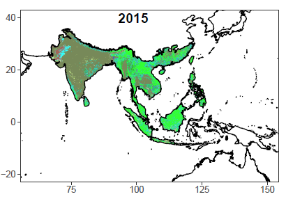
Land Cover and Land Use Change
Land cover and land use change is important for global carbon budget, environmental change assessment, agricultural planning, and convervation measures. We use novel machine learning and deep learning algorithms to imporve the accuracy of LCLU data across globe and subsequently detect its changes. The LCLUC patterns, rates, and transitions identified in our studies would be a valuable source of climate and environmental studies.
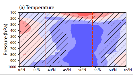
LCLUC-Atmosphere Interaction
Climate variability and extremes are a combination of internal variability, GHG emissions, and other forcings, like land cover and land use change (LCLUC). However, how comparable the different forcings is not yet sufficiently understood and quantified. The lack of process understanding and reliable quantification of impacts can be attributed to uncertainties in LCLUC information used in current LCLUC-Atmosphere interactions studies. We take the advantage of LCLUC derived from remotely-sensed data and use robust statistical methods and climate models to attribute the causes of climate variability and extremes.
Agricultural Sustainability
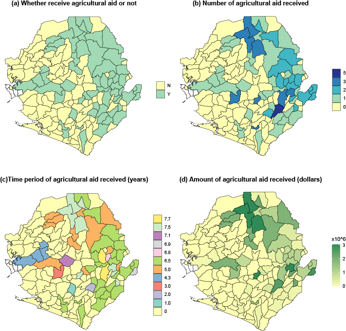
The United Nations has set up Sustainable Development Goals (SDGs) to address the necessity of reducing poverty, advancing social equity, and simultaneously ensuring environmental protection. Precision Agriculture provides an promising way to achieve the UN millennium goals. We utilize multi-source satellite and UAV imagery to identify cropland dynamics, crop diseases, crop health and its phenology, soil moisture conditions, irrigation-climate interaction, effectiveness of agriculture aid and so on.
Air Quality and Human Health
Humanity's health is vulnerable to environment changes (e.g., air quality). The pandemic of Covid-19 produces numbers of tragedies in the society. We use geospatial knowledge to reveal natural and socioeconomic drivers of various diseases to predict disease risk areas and improve the prevention implementation. We also use satellite-derived air quality data to explore the relationships between air quaility and human health.